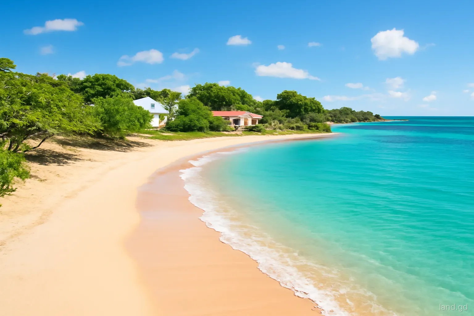
A plot on the water is the dream behind many land purchases in Grenada, and the place where planning rules bite hardest. Building close to the shore is controlled because beaches belong to everyone, because sand and dunes protect the coast, and because storm surge and erosion have repeatedly shown what happens to buildings placed too close. Hurricane Ivan in 2004 and Hurricane Beryl in 2024, which battered Carriacou and Petite Martinique, both left coastlines reshaped.
This page explains how coastal development is treated in Grenada: the high-water mark and coastal setbacks, public access to beaches, the ban on taking sand, environmental assessment, and the design choices that make a coastal building more likely to be approved and to last. Setback distances and assessment thresholds are set by policy and can vary by site, so confirm them with the Physical Planning Unit before buying or designing.
Beaches are public, and that shapes everything
In Grenada, beaches are open to the public. A deed to land along the shore gives ownership of the land behind the beach, not exclusive control of the sand in front of it. Owners and hotels can manage their own property, but they cannot lawfully stop people from using the beach itself, and public access routes to beaches are a long-standing expectation, particularly for fishermen and local families.
For planning purposes, the key line is the high-water mark: the boundary between land and the foreshore. Land seaward of it is generally public. Survey plans for waterfront parcels may show the high-water mark at the date of survey, but the shore moves, so the line on an old plan may not match today's beach.
A buyer looking at a waterfront plot should therefore ask two questions early: where the legal boundary of the parcel actually lies in relation to today's shoreline, and how far back from the shore the authority will expect any building to stand.
Coastal setbacks: what they are and why they are large
The basic rule. Planning authorities across the eastern Caribbean require buildings to be set back a minimum distance from the high-water mark or the vegetation line. The required distance in Grenada depends on the site and current policy, and it is usually much larger than an ordinary boundary setback. Ask the Physical Planning Unit for the figure that applies to a specific parcel.
Why they exist. Setbacks leave room for the beach to move with seasons and storms, protect dunes and vegetation that buffer waves, preserve public access and views, and keep buildings out of the zone most exposed to surge.
Site-specific factors. Low-lying sandy shores, eroding beaches, river mouths and areas with a history of flooding may attract larger setbacks. Rocky headlands and cliffs raise different issues, including stability of the cliff edge.
Pools, decks and walls count. Owners sometimes assume only the house is controlled. Pools, decks, boundary walls and seawalls near the shore are development too and are assessed against the same concerns.
Sand, seawalls and the beach itself
Taking sand from beaches in Grenada is prohibited under beach protection legislation, and the ban has been enforced because sand mining has historically stripped beaches and worsened erosion. Construction sand must come from approved sources or be imported, which affects building costs on the sister islands in particular.
Hard structures such as seawalls, groynes and revetments are tightly controlled. A wall that protects one property can accelerate erosion next door or strip the beach in front of it, so engineering advice and approval are needed before anything is built at the shore. The authorities may also involve fisheries and environmental bodies where reefs, seagrass or mangroves are nearby.
Mangroves and wetlands along the coast, such as those around the south and east coasts and on Carriacou, are ecologically important and often protected. Clearing or filling them without approval can bring enforcement and penalties. If a waterfront plot includes mangrove or wetland, expect close scrutiny and possibly a requirement to keep it intact.
When an environmental assessment may be needed
Larger or more sensitive coastal projects in Grenada can require an environmental impact assessment before a decision is made. The thresholds are set in law and policy and the authority decides case by case, but assessment is more likely for:
- Hotels, resorts, marinas and multi-unit residential developments on or near the shore.
- Projects involving dredging, reclamation, seawalls or other works in the water or on the beach.
- Development close to coral reefs, seagrass beds, mangroves, turtle nesting beaches or marine protected areas.
- Large clearance of coastal vegetation or alteration of drainage to the sea.
- Sites on low-lying land prone to flooding or storm surge.
- An assessment takes time and specialist consultants, and it can lead to conditions or redesign. For a single family house on a conventional lot, a full assessment is less common, but the officer may still ask for information on drainage, setbacks and vegetation.
Designing for storms, surge and a rising sea
Approval is one test; surviving the next hurricane is another. Coastal buildings in Grenada face wind, wave action, surge and salt. A house set well back and raised above likely flood levels fares far better than one perched at the sand line. Raised floor levels, strong foundations designed for scour, and keeping living spaces and electrical equipment above expected surge heights all help.
Salt air corrodes steel and fixings, so specification matters: adequate concrete cover over reinforcement, stainless or galvanised fixings, and materials that tolerate spray. Insurers increasingly ask about distance from the sea and floor heights, and premiums for exposed coastal buildings reflect the risk.
Sea level rise and stronger storms are part of planning thinking across the Caribbean. A setback that seems generous today is a buffer for the coming decades. Buyers should think of it as protecting their investment rather than taking land away from them.
Rebuilding on the coast after Hurricane Beryl
Hurricane Beryl struck Carriacou and Petite Martinique in July 2024, destroying or damaging a large share of homes and reshaping parts of the shoreline. Many owners face the question of whether to rebuild on the same footprint. Where the old house stood close to the water, the honest answer may be that rebuilding in the same place repeats the risk, and that current planning standards would not allow it as new development.
After major storms, government agencies often issue specific guidance on repairs, rebuilding and building standards, sometimes with support programmes attached. Owners on the sister islands should ask at the government offices in Hillsborough and the Physical Planning Unit what applies now, whether a rebuild needs a new application, and whether moving the house back on the plot is possible.
For anyone buying coastal land on Carriacou or Petite Martinique since Beryl, check the plot's condition on the ground rather than relying on older photographs, and confirm what remains of any previous structures and services. Availability of builders and materials on the sister islands has also been stretched by the recovery, so build that into timelines.
Mistakes buyers make with coastal land
Paying for frontage that cannot be built on. If the coastal setback consumes most of a shallow lot, the price per buildable square foot is far higher than it looks.
Trusting an old high-water mark. Beaches erode and accrete. A fresh survey shows where the shore is now.
Planning to fence the beach. Public access cannot be removed by fencing or signage. Design for passers-by.
Building a seawall first. Unapproved seawalls are a common enforcement target and can make erosion worse.
Skipping the neighbours' history. Long-time residents remember where the sea reached during Ivan and Beryl. Their accounts are free and often more telling than a brochure.
Clearing sea grape and almond trees. Coastal vegetation holds sand and breaks spray. Removing it for a view can speed erosion and may itself need permission.
Ignoring the rivers. Plots near a river mouth or gully can flood from land-side water as well as the sea. Ask neighbours about past floods.
Frequently asked questions
How far from the sea can a house be built in Grenada?
The required coastal setback depends on the site and current planning policy, and it is usually much larger than ordinary boundary setbacks. Ask the Physical Planning Unit for the figure applying to the specific parcel before buying or designing.
Can a waterfront owner stop the public using the beach?
No. Beaches in Grenada are public. Owners control their own land behind the beach, but cannot lawfully exclude people from the beach itself or block established public access routes to it.
Is it legal to take sand from the beach for building?
No. Removing sand from beaches is prohibited under beach protection law because it causes erosion. Builders must use sand from approved sources or imported supplies, and should keep receipts showing where it came from.
Does a beachfront villa need an environmental impact assessment?
A single house often does not need a full assessment, but sensitive sites near reefs, mangroves or nesting beaches may. Larger projects such as resorts and marinas commonly require one. The Physical Planning Unit decides case by case.
Can a seawall be built to protect a property from erosion?
Only with approval. Seawalls can shift erosion onto neighbours and strip the beach, so engineering studies and permission are required. Softer approaches such as setbacks and vegetation are often preferred where they will work.